SEJournal Online is the digital news magazine of the Society of Environmental Journalists. Learn more about SEJournal Online, including submission, subscription and advertising information.
 |
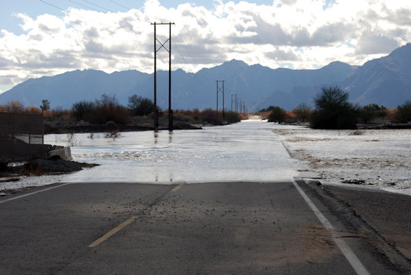
| Above, a road inundated by flood waters from the Salt River in Arizona in 2010. A new database quantifies flood risk and recently estimated that almost a quarter of U.S. roads are vulnerable. Photo: Los Angeles District USACE, Flickr Creative Commons. Click to enlarge. |
Reporter’s Toolbox: Mapping Flood Risk — Research Outfit Offers Alternative Dataset
By Joseph A. Davis
Face it, you’re going to be writing more flood stories and you need all the help you can get.
That help may be on the way with a new tool for quantifying flood risk from an unusual outfit called First Street Foundation.
First Street was in the news recently with a report estimating that almost a quarter of U.S. roads are vulnerable to flooding. It also estimated flood risk for other critical infrastructure, everything from hospitals and Superfund sites to ports and police stations (get the summary and the full report).
FEMA flood risk data can be outdated
There is a lot at stake with this issue — for too many people, flooding involves destruction and loss of their homes.
But one of the problems with flood reporting — especially at the local level — is that the best data source about flood risk isn’t always that good (we’re talking about the flood maps produced by the National Flood Insurance Program, part of the Federal Emergency Management Agency, or FEMA).
You can get these maps online for free; they are better than nothing, but they are not good enough to reliably describe all flood risk.
For one thing, they haven’t been updated fast enough — even as climate change dumps on us multiple “100-year floods” in successive seasons. For another, they are victims of political manipulation as officials finagle to lower insurance rates or build new developments.
The First Street report, on the other hand, was built on an ambitious and rigorous data project that is likely to get increasing attention as climate change tries to drown us.
Where the data comes from
The foundation is a rare kind of bird: a nonprofit research organization that gets its funding by selling a quality data product, in this case, typically to real estate and insurance companies, two industries that have a huge stake in climate change flooding.
First Street’s data comes from a lot of places — way beyond the FEMA flood maps. It is inherently geographic data, easiest to think of as a collection of map layers.
Using the data smartly depends
on lots of other things, especially
deciding what your story is about.
The bottom layer is a map of individual property parcels based on satellite images. On top of that are maps of various kinds of vulnerable infrastructure (not just roads and bridges but power plants and nursery schools). On top of that are maps of hazards; not just flood risks but things like wildfire as well.
All of this goes into a computer model that helps with estimating probabilities, and the results are peer-reviewed by a battalion of over 80 experts and eventually published.
Using the data smartly
Some of First Street’s data is available to journalists and the public — but not all. The most finely detailed data, like that showing risk for individual properties, costs money. Sometimes that will be what journalists want the most. But not always. We don’t think many publications could pay for it.
What you can get and use is data aggregated to the zip code, county and congressional district levels. This data is available for noncommercial use under a Creative Commons license that requires attribution (terms are here).
Using the data smartly depends on lots of other things, especially deciding what your story is about.
It could be interesting, for example, to match flood-prone congressional districts with how Congress members voted on things like flood insurance (or for that matter, climate change). It could be equally tempting to see how county-by-county flood risk relates to flood-protective zoning and building codes.
You could also do a lot of reporting about how flood risk relates to insurance rates and availability. But it might also be valuable to know (and write about) the special flood-related risks that apply to Superfund sites, chemical plants and drinking water treatment plants (that could require more access than you can afford).
The documentation available is a bit hard to find and jargony, but informative if you can follow it into the intricacies of First Street’s elaborate modelling process. It certainly helps if you have experience and skill with Esri map software.
One starting point for exploring the data is a query engine it calls Flood Factor. Start by using it to input a single address that you care about and it will give you a rating of flood risk.
By the way, even if you do not want to do a data reporting project, it is worth glancing regularly at its media page, because it issues reports fairly often on which stories can be built (we are waiting for the one on wildfire risk).
Joseph A. Davis is a freelance writer/editor in Washington, D.C. who has been writing about the environment since 1976. He writes SEJournal Online's TipSheet, Reporter's Toolbox and Issue Backgrounder, and curates SEJ's weekday news headlines service EJToday and @EJTodayNews. Davis also directs SEJ's Freedom of Information Project and writes the WatchDog opinion column.
* From the weekly news magazine SEJournal Online, Vol. 6, No. 37. Content from each new issue of SEJournal Online is available to the public via the SEJournal Online main page. Subscribe to the e-newsletter here. And see past issues of the SEJournal archived here.


