


SEJournal Online is the digital news magazine of the Society of Environmental Journalists. Learn more about SEJournal Online, including submission, subscription and advertising information.
June 1, 2022

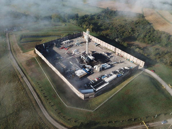 |
| A new database claims to include every active oil and gas production facility in the United States. Above, an aerial photo of a fracking operation in Westmoreland County, Pa., in 2021. Photo: Ted Auch/FracTracker Alliance, Flickr Creative Commons (CC BY-NC 2.0). |
Reporter’s Toolbox: Massive Drilling Database Helps Track Threats From Local Oil, Gas Wells
By Joseph A. Davis
While the wars over oil and gas drilling have ground on over recent years, some amazing tools have become more accessible to data journalists.
Now there is a database claiming to include every active oil and gas production facility in the United States. We believe it comes close.
This data could be a starting foundation for all kinds of stories. Take the data; draw your own conclusions. Good journalists will ground-truth everything they can.
Where the data comes from
The service is called the Oil & Gas Threat Map, and it’s compiled by two environmental advocacy groups: Earthworks and the FracTracker Alliance. Of course, they have an ax to grind. But data is data.
They say they have identified and mapped every oil and gas production facility in the United States. Not just wells, but other upstream facilities like compressors and processing stations. That’s impressive, even though no data is perfect.
In all, it amounts to some 1,554,394 facilities. The data is from 2020 and 2021. The documentation of sourcing is thorough and transparent.
These groups went to the trouble of
querying all 50 states about the
location of oil and gas facilities.
These groups (primarily the FracTracker Alliance) went to the trouble of querying all 50 states about the location of oil and gas facilities. The data include active facilities — not historical or abandoned ones. In almost all cases, the data was downloaded directly from the websites of state permitting agencies.
The FracTracker crew acknowledges that they use multiple data sources: not just state agencies but Oak Ridge National Laboratory and the Department of Homeland Security.
How to use the data smartly
Let’s face it: While the data is valuable, the presenters are making a point — and if you take it without the requisite grains of salt you may be misleading your audience.
Many oil and gas facilities are indeed threats to environmental health. Many others may not be. The “threat map” does not distinguish. The mere assumption that all wells are toxic, within a certain radius, is contentious and misleading.
On the other hand, if there is one near a local nursery school, you will want to know about it.
The biggest pollutant you need to worry about with most oil and gas wells is methane — which is bad for the climate but rarely poisons people. The second most common (or dangerous) is hydrogen sulfide, which can be acutely toxic but warns you with its smell.
There is a long list of others, some of which (like benzene) are emitted in smaller amounts and can cause cancer with chronic exposure. But a well-built and -maintained well should emit very little of these gases.
Wells that are “fracked” involve more substances — and the problem with these is that the law allows companies to keep secret the chemical ingredients of fracking fluid, some of which come back up the well. Industry’s penchant for secrecy only encourages a “what are they hiding” outlook.
Despite these problems, the Oil & Gas Threat Map makes your job easier by overlaying the map of well and facility locations with data layers showing demographics (from the census) and school locations (from the Department of Education).
Story ideas and resources
If you are serious about specific wells and facilities, you will buy an air pollution detection meter (which can cost between several hundred and several thousand dollars) and take readings for yourself.
Evaluating the pollution potential of a specific well or facility should probably include direct investigation of produced water and wastewater from the site. What’s in it and what happens to it?
Using the “threat map” you should be able to get the permit for the well or facility in question. What is the inspection and enforcement record for that well?
Finally: Don’t take our warnings the wrong way. Yes, proximity to oil and gas facilities can be harmful to people’s health. Take the time to read Kristina Marusic’s series “Fractured: The body burden of living near fracking,” published in Environmental Health News.
Read especially her methodology — EHN tested air, water and urine samples in five Southwestern Pennsylvania households (fracking country) and had them tested in a university lab for 40 different chemicals. The point is that it takes a lot of reporting to reach the conclusions that matter.
Joseph A. Davis is a freelance writer/editor in Washington, D.C. who has been writing about the environment since 1976. He writes SEJournal Online's TipSheet, Reporter's Toolbox and Issue Backgrounder, and curates SEJ's weekday news headlines service EJToday and @EJTodayNews. Davis also directs SEJ's Freedom of Information Project and writes the WatchDog opinion column.
* From the weekly news magazine SEJournal Online, Vol. 7, No. 22. Content from each new issue of SEJournal Online is available to the public via the SEJournal Online main page. Subscribe to the e-newsletter here. And see past issues of the SEJournal archived here.
SEJ Publication Types:
Topics on the Beat:
Region:
Visibility:

